The widespread way of presenting geographical maps is called the Mercator projection, and it is the cylindrical map projection invented by Gerardus Mercator, a Flemish cartographer. But what if there are other ways of looking at the world map without being inaccurate?
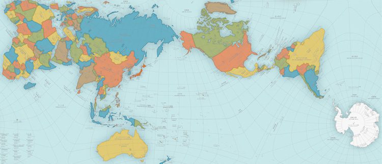
Mercator’s vision has been the standard view since 1569, but many geographical areas are in fact presented inaccurately and they seem larger than they are in comparison to other territories. So, to rescale the world map and bring everything into the right proportions, Hajime Narukawa, a Japanese designer, studies the map for years and came up with a new approach.
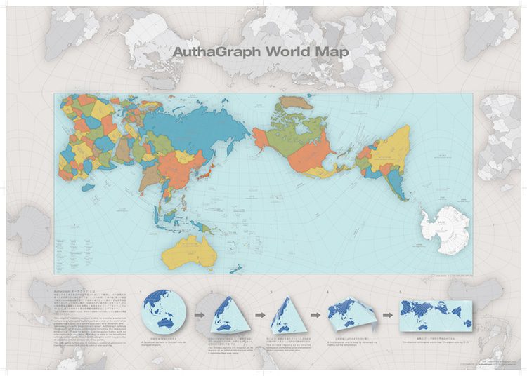
To solve the centuries-old flaw, he created a new view of the world map called AuthaGraph which is both a bi- and tri-dimensional map and is a correctly proportioned rendering of Earth. The map can even be printed and assembled at home as origami, so you can have your very own 3D map.
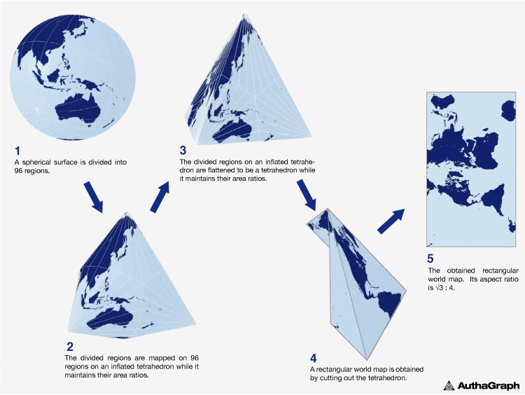
An original method for keeping areas’ proportions is called “iso-area-mapping.”
And an original mapping process by combining different projection methods via intermediate objects is called “multilayer-mapping.” These ideas for mapping aims to reduce errors during projecting a sphere to a tetrahedron because a simple optical projection from a sphere to a tetrahedron causes huge distortions therefore useless.
Check out a world map using the AuthaGraph projection method HERE…
A world map poster that can be framed or pasted directly on the wall
We deliver a world map using the AuthaGraph projection method in a handy poster format. It can be pasted directly on the wall or framed, but framing makes it look more luxurious.